Weather in Horsholm – February 2022


Extremely Wet and Very Mild

Temperatures

The average maximum temperature during February 2022 in Horsholm was 6.6 Celsius, and that was around 2 degrees above normal for the time of year. The average minimum temperature was 0.5 Celsius, and that was more than 1 degree above the monthly normal.

The highest temperature recorded during the month was 9.4 Celsius on the 8th, but there were 5 other days with maxima above 8 Celsius, including the 14th, when the temperature reached 8.8 Celsius. A further 5 days had highs above 7 Celsius. On most other days (13) the temperature rose to between 5 and 7 Celsius. No particularly cold days occurred during February, with the remaining 4 days having maximum temperatures between 4 and 5 Celsius. The 11th, 12th and 13th each had maxima below 5 Celsius, the coldest of which was the 12th with a high of 4.4 Celsius. However, the coldest day of the month was the 2nd with a top temperature of 4.1 Celsius.

There were no particularly mild nights during February, with the highest minimum being 4.1 Celsius. However, there were 5 other nights with minima between 3 and 4 Celsius, with all of the milder nights, bar 2, occurring between the 14th and 17th. The exceptions were on the 23rd, when a minimum of 3.8 Celsius occurred, and the 9th, when 3.1 Celsius was recorded. The latter temperature followed a minimum of 2.9 Celsius on the 8th, the only other value above 2 Celsius. On many nights (13) minimum temperatures were between zero and 2 Celsius. However, there were a few colder nights. On the 1st a minimum of minus 3.9 Celsius occurred, with minus 5.7 Celsius recorded on the 27th, followed by minus 4.8 Celsius on the last night of the month.

Frost

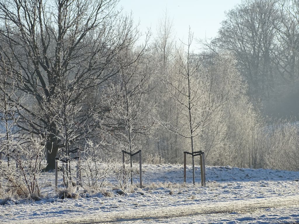
There were 8 air frosts during February, and that was 5 less than normal. Apart from on the 22nd, when a minimum of minus 1.8 Celsius occurred, the frosts occurred in 3 clusters. The 1st and 2nd, the 11th and 12th, and the 26th to 28th. Although only 8 air frosts occurred, there were 7 nights with minima between zero and 1 Celsius.

Rain

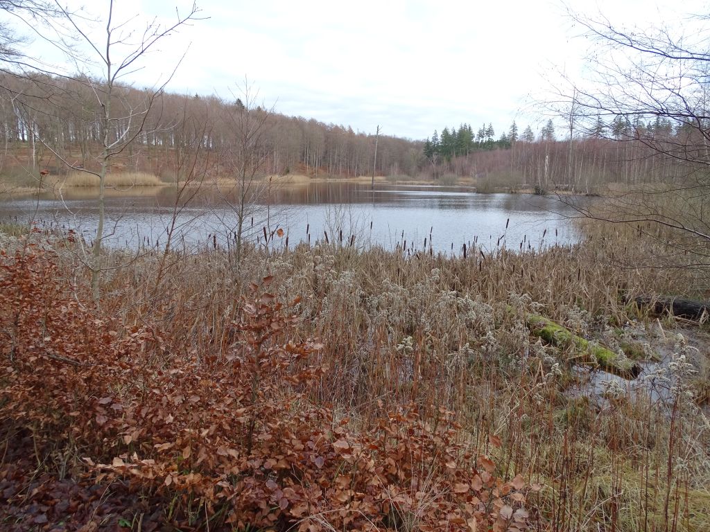
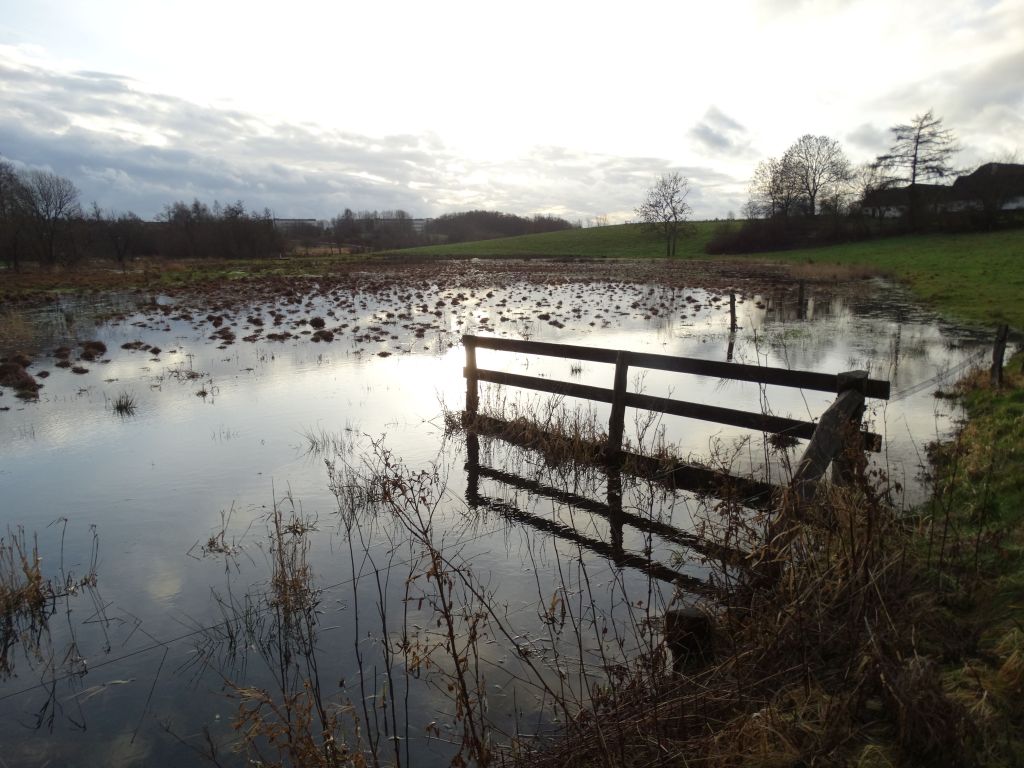
A total of 95.0 millimetres of rain was measured during February, which was more than double the monthly average. Overall, it was the second wettest February in Denmark since records began in 1874. Only the February of 2020 was wetter. Measurable rain was recorded on 23 days, which was 8 days above average. The month began wet with 6 millimetres recorded on the 1st. In fact, precipitation was measured on each of the first 11 days of the month. Daily totals included 6.0 millimetres on the 4th and 7.2 millimetres on the 6th. After 3 dry days, the remainder was often wet with the 23rd the only dry day until the last day of the month. Some of the precipitation was heavy with 11.6 millimetres measured on the 16th, another 12.2 millimetres on the 18th, and 13.4 millimetres on the 21st. ‘Rain’ on both the 26th and 27th amounted to 0.2 millimetres, caused by the melting of heavy overnight frost.

Hail

Two showers of small hail occurred early in the afternoon on the 6th.

Thunder

There was one rumble of thunder early in the afternoon of the 6th, a most unusual event for February.

Snow

Sleet or snow fell on 5 days during February, and half cover, or more, of lying snow was observed on 1 morning. Light snow fell overnight on the 1st, with further snow mid to late morning. There were 2 centimetres of lying snow mid-morning, but it had thawed by the end of the afternoon. Moderate sleet fell for a while on the evening of the 4th, and there was a sleet shower mid-evening on the 6th. Sleet and wet snow fell late afternoon and early evening on the 18th, and although it was heavy at times, it failed to settle. Wet snow late evening on the 24th did settle for a while, but only a few patches remained on the ground by the following morning.

Wind

It was a windy February, especially after mid month, although the last 3 days were much quieter. On most days (22) winds blew from between south and west, with northwesterly and southeasterly winds prevailing on 3 days each. The southwesterly winds were at their strongest on the 17th and 21st.  

Fog

There was no fog observed in Horsholm.

Weather in Horsholm – January 2022


Mild and Changeable

Temperatures

The average maximum temperature during January 2022 in Horsholm was 5.5 Celsius, and that was around 1.5 degrees above normal for the time of year. The average minimum temperature was 1.1 Celsius, and that was also close to 1.5 degrees above the monthly normal.

The highest temperature recorded during the month was 9.7 Celsius on the 2nd, but a maximum of 9.2 Celsius was recorded on the 1st, and both the 13th and 14th had highs exceeding 8 Celsius. On most days (17) the maximum temperature was between 4 and 8 Celsius, but there were some colder days, more especially during the first half of January. On 10 days the temperature failed to reach 4 Celsius, including 6 consecutive days commencing on the 6th. The lowest maxima were 2.3 Celsius, recorded on both the 7th and 11th, 2.7 Celsius, recorded on the 9th, and 2.8 Celsius, which occurred on the 20th.

There were no particularly mild nights during January, but the temperature only fell to 7.3 Celsius on the 2nd, and minima were above 6 Celsius on 3 other nights, the 1st, 3rd and 13th. On 4 other nights, the temperature stayed above 3 Celsius, with all of these less cold nights occurring between the 23rd and the 27th. On many nights (15) the temperature fell to between minus 2 and plus 2 Celsius, with 13 of these ‘close to zero’ temperatures occurring between the 4th and 21st. There were no notably cold nights during January, with minima only below minus 3 Celsius on 3 occasions. On the 6th, minus 3.9 Celsius was recorded, minus 3.3 Celsius occurred on the 15th, but the last night of the month was the coldest with a minimum of minus 4.2 Celsius.

Frost

There were 12 air frosts during January, and that was 3 less than normal. Many of the frosts were slight with minimum temperatures on 5 nights no more than a degree below freezing. The majority of frosts occurred between the 5th and 22nd, but the only spell with 3 consecutive frosty nights was between the 5th and 7th.

Rain

A total of 44.8 millimetres of rain was measured during January, which was very close to the monthly average. Measurable precipitation fell on 22 days, which was 3 days above average. Similar to the previous month, the heaviest rain fell early on, with the fall of 14.6 millimetres on the 2nd accounting for over 30% of the monthly total. There was measurable precipitation on 8 out of the first 9 days in January, but no other daily totals above 3 millimetres occurred. Between the 10th and 25th, although occasional precipitation fell, no days had more than 2.4 millimetres, and the total for this 16-day period was only 7.4 millimetres. Heavier rain fell at the end of the month, with 6.8 millimetres falling on the 27th, and a further 6.2 millimetres measured on the 29th.

Hail

Spherical soft hail, the size of marbles, fell in a brief shower on the afternoon of the 20th.

Thunder

There was no thunder in this part of Horsholm.

Snow

Sleet or snow fell on 5 days during January, and half cover, or more, of lying snow was observed on 2 mornings. Light snow fell late in the evening on the 5th, and a few thin patches remained on the ground until the morning of the 7th. Sleet fell late morning until mid-afternoon on the 7th, with further sleet falling mid to late morning on the 8th, and again early to late morning on the 9th. Snow showers fell overnight on the 20th, with 2 centimetres of lying snow by morning. The snow decreased to 1 centimetre by the morning of the 21st and had thawed completely by the end of the afternoon.

Wind

Winds were mainly from the southwest during January and accounted for over 60% of the daily observations. On most other days, winds were either from the west or northwest, with just a brief interlude between the 9th and 11th when winds blew from between south and east. Strong winds blew at times around mid-month and at the end of the third week, but the strongest winds were reserved for the end of the month, when winds associated with ‘Storm Malik’ brought estimated gusts of 50 to 55 knots to the Horsholm area on the evening of the 29th and the morning of the 30th.  

Fog

There was no fog observed in Horsholm.

Weather in Horsholm – December 2021


Cold and often Wintry

Temperatures

The average maximum temperature during December 2021 in Horsholm was 3.6 Celsius, and that was more than 2 degrees below normal for the time of year. The average minimum temperature was minus 0.6 Celsius, and that was nearer 3 degrees below the monthly normal.

The highest temperature recorded during the month was 9.3 Celsius on the 15th, but a maximum of 9.0 Celsius was recorded on the 31st, and there were 3 other days with maxima above 8 Celsius, including a high of 8.6 Celsius on the 30th. There were only 4 other days with maxima above 5 Celsius, and on many days (12) the highest temperatures were between 1 and 3 Celsius. On 5 occasions the maximum temperature hovered around zero (between 0.2 and minus 0.2 Celsius). The lowest value of minus 0.2 Celsius occurred on 2 days, the 6th and 26th.

There were no mild nights during December, but the temperature only fell to 6.4 Celsius on the 31st. There were no other nights with minima above 5 Celsius, although a low of 4.7 Celsius occurred on the 15th, and minima between 3 and 4 Celsius were measured on 6 nights. Apart from the 31st, all of the less cold nights occurred between the 13th and 19th. Only 7 more nights had lows above freezing, and 4 of those nights had minimum temperatures between 0 and 1 Celsius. On 5 nights the temperature fell below minus 5 Celsius, and it was particularly cold over the festive period, with lows of minus 8.9, minus 9.1 and minus 7.2 Celsius, on the 24th, 25th and 26th respectively.

Frost

There were 16 air frosts during December, and that was 9 more than normal. They occurred in 2 spells. Between the 1st and 12th there were 9 air frosts, and on 2 of the frost-free nights (the 8th and 9th) minimum temperatures were below 1 Celsius. On the frosty nights, minima were mostly between zero and minus 3 Celsius, but the first 3 nights of the month were colder, although the only value below minus 4 Celsius was on the 1st, when minus 4.4 Celsius was recorded. The second spell of frosty nights occurred between the 20th and 27th with only 1 night, the 22nd, having a minimum temperature above zero, and on that night the low was 0.1 Celsius.

Rain

A total of 62.4 millimetres of rain was measured during December, which was about 25% above the monthly average. Measurable precipitation fell on 19 days, which was 2 days below average. Almost one third of the monthly total fell on the first day of December, with 20.2 millimetres measured. Another 8.8 millimetres occurred on the 3rd, but other 24-hour totals during the first 11 days of the month were all of 1 millimetre or less. On the 12th, there were 7.8 millimetres recorded, with a further 5.2 millimetres on the 14th. After mid-month, precipitation was less heavy, and although significant rain was recorded on 12 days, the only 2 daily readings above 2 millimetres, were the 2.6 millimetres on the 22nd, and the 9.4 millimetres that fell on the 31st.

Hail

No hail was observed in this part of Horsholm.

Thunder

There was no thunder in this part of Horsholm.

Snow

Sleet or snow fell on 11 days during December, and half cover, or more, of lying snow was observed on 11 mornings. Snow and sleet overnight on the 1st didn’t settle, but in the evening, more significant snow fell and continued until the early hours of the 2nd. By morning, there were 6 centimetres of snow lying. The depth had decreased to 5 centimetres by the following morning, and only large patches were left at 10 o’clock on the 3rd. A fairly similar event occurred on the 10th, with sleet early in the day, and snow in the evening and overnight. On the morning of the 11th, the snow depth was 4 centimetres, but that thawed by the end of the day. Light snow fell on the afternoon and evening of the 21st and continued for a while overnight. In the morning there were 2 centimetres of snow lying. The snow thawed quickly, and although snow fell on the 23rd, it didn’t accumulate until later in the day. On the morning of the 24th there were 3 centimetres of snow lying, and although it had decreased to 2 centimetres by the following morning, a full cover of snow remained until late morning on the 29th. Further snow or snow grains fell on both the 27th and 28th, but the precipitation was light and had little impact on the existing snow.

Wind

Winds were mainly from between southwest and southeast and accounted for around two thirds of the daily observations. The wind was generally lighter than normal, but the first 8 days were breezy at times, and with temperatures not far from zero, the easterly winds on the 5th and 8th were particularly unpleasant. The brisk northwesterly wind on the 19th was less harsh, but that could not be said about the bone-chilling southeasterlies that blew on both the 27th and 28th.  

Fog

There was thick fog for most of the day on the 13th.

Weather in Horsholm – November 2021


Mild and Rather Dry

Temperatures

The average maximum temperature during November 2021 in Horsholm was 8.7 Celsius, and that was less than a degree above normal for the time of year. The average minimum temperature was 3.9 Celsius, and that was also less than a degree above the monthly normal.

The highest temperature recorded during the month was 13.7 Celsius on the 1st, but a maximum of 12.8 Celsius was recorded on the 19th, and there were 7 other days with maxima between 11 and 12 Celsius. There were no cold days during the first half of November with 7.8 Celsius the lowest maximum, this occurring on the 8th. After mid month, there were 9 colder days, although the lowest temperature up until the 26th was 6.8 Celsius measured on the 16th. The last 5 days of the month became much colder, A steady decline from 5.1 Celsius on the 26th, to 1.6 Celsius on the 29th, was followed by a high of 4.1 Celsius on the 30th.

There were no especially mild nights during November, but the temperature only fell to 9.5 Celsius on the 19th, with 9.4 Celsius recorded on the 10th. On 3 other nights, the 1st, 6th and 20th, the temperature stayed above 8 Celsius. On many nights (15) the temperature fell to between 3 and 8 Celsius, but there were several colder nights. Between the 1st and the 20th only 2 nights had minima below 3 Celsius. The 3rd and 4th each had minima of 0.7 Celsius. The 21st, with a low of minus 1.6 Celsius, was 10.4 degrees colder than the previous night. The following night, the 22nd, was the coldest of the month with a minimum of minus 4.2 Celsius. The last 2 nights of the month were also cold with lows of minus 3.2 and minus 3.6 Celsius respectively.

Frost

There were 5 air frosts during November, with all of these occurring after the 20th.  

Rain

A total of 30.2 millimetres of rain was measured during November, which was about 20% below the monthly average. Measurable precipitation fell on 17 days, which was 4 days below average. The beginning of November was rather unsettled, although amounts of rain were initially quite small. However, 3.8 millimetres were recorded on the 6th, and 5.2 millimetres fell on the 7th. Plenty of dry weather occurred between the 8th and 24th, and although 3.4 millimetres of rain fell, there were no days recording more than 0.8 millimetres. On 5 out of the last 6 days of the month daily rainfall exceeded 1 millimetres, with 4.2 millimetres falling on the 28th, and 5.2 millimetres measured on the 30th.

Hail

No hail was observed in this part of Horsholm.

Thunder

There was no thunder in this part of Horsholm.

Snow

Light sleet fell late on the evening of the 27th, with early morning sleet and wet snow on the 29th. On the 30th, On the 30th there was snow, then sleet, overnight. there was no lying snow. in this part of Horsholm.

Wind

Winds were mainly from between west and southwest during November and accounted for over 50% of the daily observations. A run of south to southeasterly winds occurred during parts of the second and third weeks, and easterlies briefly occurred during the cold weather at the end of the month. Southwesterly winds were quite strong on the mild days during the second and third weeks, otherwise winds were typically gentle or moderate in strength.  

Fog

There was no fog observed in this part of Horsholm.


Weather in Horsholm – October 2021


Mild and Changeable 

Temperatures

The average maximum temperature during October 2021 in Horsholm was 13.7 Celsius, and that was about a degree above normal for the time of year. The average minimum temperature was 6.8 Celsius, and that was close to the monthly normal.

The highest temperature recorded during the month was 18.2 Celsius on the 3rd, but a maximum of 17.1 Celsius was recorded on the 4th, and there were 7 other days with maxima above 15 Celsius. Only 2 of these milder days occurred after the 9th, but there was no particularly cold weather with only 2 days having maximum temperatures below 10 Celsius. On the 18th, a high of 9.3 Celsius occurred, with 9.5 Celsius measured on the 22nd.

There were no especially mild nights during October, but on 7 occasions the minimum temperature was above 10 Celsius including the first 4 nights of the month. The highest minimum was 13.4 Celsius on the 3rd, with 12.3 Celsius measured on the 20th. There were several fairly cold nights and on 10 nights the minimum temperature was below 5 Celsius. On 4 of these colder nights the temperature fell below 3 Celsius, with the lowest values occurring on the 10th and 13th. On the 10th, the low was 0.8 Celsius, with 1.2 Celsius recorded on the 13th.

Frost

No frosts were recorded during the month.  

Rain

There were 66.6 millimetres of rain measured during October, which was very close to the monthly average. Measurable precipitation fell on 26 days, which was 4 days above average, although on 4 days the ‘precipitation’ consisted of dew. The beginning of October was unsettled, and on the 5th a total of 13.2 millimetres of rain fell. Measurable dew occurred on the following 2 nights, before further changeable weather occurred towards the end of the second week. Amounts of rain were mostly small, except for the 3-day spell beginning on the 20th. A total of 30.6 millimetres fell during 72 hours, including a fall of 10.6 millimetres on the 20th, and 11.2 millimetres on the 21st. Further rain fell during the rest of October but amounts were 2 millimetres or less.

Hail

No hail was observed in this part of Horsholm.

Thunder

There was no thunder in this part of Horsholm.

Snow

No sleet or snow was observed in this part of Horsholm.

Wind

Winds were mainly from the south or southwest during October and accounted for nearly 80% of the daily observations. Southeasterly winds occurred on 4 days, but winds having a northerly component were almost entirely absent. For an autumn month, the winds were surprisingly light, although at the end of the third week and the beginning of the fourth the southwesterly winds were strong at times.  

Fog

There was some evening fog early in the month, but no overnight fog lingered beyond mid morning.

Weather in Horsholm – September 2021


Typical early Autumn Weather 

Temperatures

The average maximum temperature during September 2021 in Horsholm was 18.6 Celsius, and that was normal for the time of year. The average minimum temperature was 9.7 Celsius, and that was less than a degree below the monthly normal.

The highest temperature recorded during the month was 24.7 Celsius on the 10th, but the maximum was 24.1 Celsius on the 9th, and only 2 out of the first 12 days of September had highs below 20 Celsius. After the 12th, there were no days with maxima above 20 Celsius, in fact, on 4 days the temperature failed to reach 15 Celsius. The cool days were the 19th, 20th and 21st, along with the 30th. The only 2 of those days with maxima below 14 Celsius were the 21st and 30th with highs of 12.5 and 13.1 Celsius respectively.

There were 2 warm nights during September. On the 11th, a minimum of 15.7 Celsius was recorded, with 15.1 Celsius occurring on the 8th. Although 14.4 Celsius was the minimum on both the 12th and 16th, there were only 9 other nights with minima above 10 Celsius. On most other nights the temperature fell to between 5 and 10 Celsius, but on 3 nights it was cooler. A minimum of 3.6 Celsius occurred on the 5th, with 4.9 and 4.6 Celsius measured on the 6th and 29th respectively.

Frost

No frosts were recorded during the month.  

Rain

There were 50.2 millimetres of rain measured during September, which was about 10% below the monthly average. Rain fell on 13 days, which was 2 days below average. The first 10 days of the month were dry, but then the weather became unsettled. Initially, rainfall was light with falls of 0.4 and 1.0 millimetres on the 11th and 12th respectively. Following 2 dry days, 8.2 millimetres fell on the 15th, with over 2 millimetres falling on both the 16th and 17th. A drier interlude ended with 4.6 millimetres of rain measured on the 23rd, and although a couple of days of lighter rain followed, the end of the month was wet. The last 4 days of September produced 60% of the monthly total. On the 28th, 8.6 millimetres of rain fell, with 13.4 millimetres on the 29th. The last day of the month added another 4.4 millimetres to the total.

Hail

No hail was observed in this part of Horsholm.

Thunder

There was no thunder in this part of Horsholm.

Snow

No sleet or snow was observed in this part of Horsholm.

Wind

Winds were mainly between southeast and southwest during September, with breezes having a northerly component accounting for less than 25% of the monthly total. During the first 2 weeks of the month, winds were mostly light, but moderate or fresh winds sometimes occurred after mid-month, and on the 23rd the wind was strong for a while with minor tree damage noticed.  

Fog

There was no fog observed in Horsholm during the month.

Weather in Horsholm – August 2021


Very Cool and Wet 

Temperatures

The average maximum temperature during August 2021 in Horsholm was 20.4 Celsius, and that was around 2 degrees below normal for the time of year. The average minimum temperature was 11.3 Celsius, and that was over a degree below the monthly normal.

The highest temperature recorded during the month was 25.9 Celsius on the 13th, but there were no more days with maxima above 24 Celsius, and only 3 other days, the 5th,6th and 12th had highs above 23 Celsius. The highest temperatures generally occurred during the first half of August, with 10 of the 16 days having maxima between 20 and 23 Celsius occurring before mid month. Just 1 day, the 9th, had a maximum below 20 Celsius, during the first half of August; whereas 10 days after mid month had maxima below 20 Celsius. There were 2 decidedly cool days, the 26th and 28th, with maximum temperatures of 15.6 and 15.4 Celsius respectively.

There were no warm nights during August. The highest minima were 14.4 Celsius on both the 13th and 18th, and 14.2 Celsius on both the 25th and 29th. Although temperatures on most nights (18) fell to between 10 and 14 Celsius, there were several cool nights. On 5 nights, the temperature fell below 8 Celsius, including 3 consecutive nights beginning on the 22nd. The lowest values were 6.9 Celsius on the 5th, and 4.9 Celsius on the 22nd.

Frost

No frosts were recorded during the month.  

Rain

No information was available.

Hail

No hail was observed in this part of Horsholm.

Thunder

There was thunder heard late morning and early afternoon on the 8th, and early in the evening on the 17th.

Snow

No sleet or snow was observed in this part of Horsholm.

Wind

Southwesterly and northwesterly winds were dominant during August, accounting for around two thirds of the daily observations. On other days winds were either from the north or the south. Only 4 days had winds with an easterly component, and just 2 of those days, the 6th and 22nd, had a wind blowing from the southeast.  

Fog

There was no fog observed in Horsholm during the month.

Weather in Horsholm – July 2021


Warm and often Sunny 

Temperatures

The average maximum temperature during July 2021 in Horsholm was 24.1 Celsius, and that was around 2 degrees above normal for the time of year. The average minimum temperature was 14.8 Celsius, and that was over 2 degrees above the monthly normal.

The highest temperature recorded during the month was 29.9 Celsius on both the 14th and 16th, but the temperature reached 29.3 Celsius on the 15th, and there were 10 other days when the maximum exceeded 25 Celsius. On most other days, the temperature rose to between 20 and 25 Celsius, and there were only 2 exceptions. On both the 10th and 29th the maximum temperature was only 19.9 Celsius.

There were several warm nights during July, and on the 16th the temperature only fell to 19.6 Celsius. The 27th was almost as warm with a minimum of 19.3 Celsius, and there were 11 further nights with minima above 15 Celsius, including 5 nights with lows above 17 Celsius. There were no particularly cool nights, although on 9 nights the temperature fell below 13 Celsius. However, only 2 of these cooler nights had minima below 11 Celsius. On the 22nd a minimum of 10.4 Celsius was recorded, with the following night dipping to 10.3 Celsius.

Frost

No frosts were recorded during the month.  

Rain

48.2 millimetres of rain fell during July, which was very close to the monthly average. Measurable precipitation fell on 11 days, and that was 3 days below average, and wet days (when 1 millimetre or more of rain was measured) numbered 9 days, and that was 1 day above average for the month. The first 10 days of July were changeable, although during this period there were 3 dry days. Rainfall was mostly light, but 5.6 millimetres was measured on the 6th, and a further 15.8 millimetres fell on the 10th. It then stayed dry until the 26th. The last 4 days of the month were unsettled, and although rain was fairly light on the 28th and 31st, the 29th and 30th were much wetter with falls of 5.8 and 8.6 millimetres respectively.

Hail

No hail was observed in this part of Horsholm.

Thunder

There was thunder heard early in the evening on the 6th, and again late in the afternoon on the 31st.

Snow

No sleet or snow was observed in this part of Horsholm.

Wind

Although southwesterly winds were dominant, accounting for around 30% of the daily observations, southeasterly breezes were not far behind, and winds with a northerly component amounted to less than 25% of the monthly total. Generally, winds were much lighter than normal, with only 2 days, the 18th and 29th, noticeably breezy, and with just 1 windy day, the 30th, when southwesterlies were strong in the afternoon.  

Fog

There was no fog observed in Horsholm during the month.

Weather in Horsholm – June 2021


Very Dry, some Warm days 

Temperatures

The average maximum temperature during June 2021 in Horsholm was 22.5 Celsius, and that was around 0.5 degrees above normal for the time of year. The average minimum temperature was 11.5 Celsius, and that was close to the monthly normal.

The highest temperature recorded during the month was 30.7 Celsius on the 19th, but the temperature reached 29.1 Celsius on the 18th, and there were 4 other days when the maximum exceeded 25 Celsius. On most days (17), the temperature rose to between 20 and 25 Celsius, but a few rather cool days occurred, On 6 days the temperature failed to reach 20 Celsius, and on 3 of these cooler days maximum temperatures were below 19 Celsius. On the 12th, a high of 18.4 Celsius was recorded, with 18.6 Celsius measured on the 15th, but the coolest day of the month was the 30th with a high of 18.2 Celsius.

There was only 1 warm night during June, and that was on the 18th when the minimum temperature was 16.9 Celsius. However, on 2 other nights, the 19th and 30th, the temperature stayed above 15 Celsius. On most nights (18), the minima were between 10 and 15 Celsius, but several cool nights occurred. On 9 occasions, the temperature dipped below 10 Celsius, but only 2 of these cooler nights had lowes under 8 Celsius. On the 5th, the temperature fell to 7.4 Celsius, but the 16th was cooler, with a minimum of 6.3 Celsius.

Frost

No frosts were recorded during the month.  

Rain

There were only 14.4 millimetres of rain recorded during June, and that was about 30% of the monthly average. Measurable precipitation fell on just 3 days, and that was 9 days below average, and wet days (when 1 millimetre or more of rain was measured) also numbered 3 days, and that was 5 days below average for the month. The first measurable rain did not occur until the 20th, breaking a dry spell that lasted for 24 days. Only 2.4 millimetres were recorded, with a similar amount occurring on the following day. After another 8 days of dry weather, the last day of the month was wet, with 9.6 millimetres added to the monthly total.

Hail

No hail was observed in this part of Horsholm.

Thunder

There was thunder heard early in the afternoon on the 20th.

Snow

No sleet or snow was observed in this part of Horsholm.

Wind

High pressure was close by to the south for most of the month. This resulted in mostly light or gentle winds from between southwest and northwest. The exceptions were the first few days of the month when winds were from the southeast, the end of the second week when westerly winds were moderate or fresh at times, and the last 3 days of the month when breezes blew from between east and northeast.  

Fog

There was no fog observed in Horsholm during the month.


Weather in Horsholm – May 2021


Cold and Very Wet 

Temperatures


The average maximum temperature during May 2021 in Horsholm was 15.3 Celsius, and that was around 2.5 degrees below normal for the time of year. The average minimum temperature was 6.3 Celsius, and that was less than 0.5 degrees below the monthly normal.

The highest temperature recorded during the month was 24.0 Celsius on the 10th, but there were only 3 other days with maxima above 20 Celsius. On the 9th, a high of 21.3 Celsius occurred, and the last 2 days of the month had maxima of 22.9 and 23.2 Celsius respectively. There were only 3 other days, the 24th and the 29th, when the temperature rose above 17 Celsius. On most days (19) the maximum temperature was between 12 and 17 Celsius (54-63F), but on 5 consecutive days, beginning on the 3rd, the temperature failed to reach 12 Celsius, with 3 of these colder days, the 4th, 5th and 6th, having maxima below 10 Celsius. The coldest day was the 6th with a high of 8.6 Celsius, but the previous day was only 0.2 Celsius less cold.

There was only 1 mild night during May, that was on the 10th when 14.3 Celsius was recorded. Only 2 other nights, the 12th and 13th, had minima above 10 Celsius. Both nights had lows of 10.8 Celsius. On many occasions (15) the temperature fell to between 4 and 8 Celsius, but there were some lower values. The 24th had a minimum of 3.9 Celsius, but this was the only reading below 4 Celsius after the 8th. Between the 1st and 8th, there were 7 occasions with minima below 4 Celsius, including the first nights of May when the temperature fell below 3 Celsius. However, the only measurement below 2 Celsius was on the 2nd when 0.7 Celsius was recorded.

Frost

No air frosts were recorded during the month.  

Rain

There were 78.8 millimetres of rain recorded during May, and that was about 3 times the monthly average. Across Denmark as a whole, it was the wettest May since 1983, and the second wettest since records began in 1847. Measurable precipitation fell on 19 days, and that was 8 days above average, and wet days (when 1 millimetre or more of rain was measured) numbered 17 days, and that was 10 days above average for the month. the first 2 days of the month were dry, but each day during the following week had rain, with daily totals which included 11.8 millimetres on the 4th, and 5.2 millimetres on the 5th. There were only 2 further dry days before the 18th, and sometimes rain was quite heavy. On the 13th, a fall of 7.2 millimetres occurred, with 5.0 and 7.8 millimetres recorded on the 16th and 17th respectively. After 3 dry days, rain occurred on all bar 1 day between the 21st and 27th. Much of the rain was light, but 9.4 millimetres were measured on the 25th. The last 4 days of the month were dry.

Hail

No hail was observed in this part of Horsholm.

Thunder

There was thunder heard on 3 days during May. On the 13th, thunder occurred early in the afternoon, with an early afternoon thunderstorm also occurring on the 17th. The last thunderstorm was early in the evening on the 21st.

Snow

No sleet or snow was observed in this part of Horsholm.

Wind

It was a very cyclonic month but with almost two-thirds of the winds arriving from between southeast and southwest. Often this would be a warm direction, but skies were frequently cloudy, and the rain or showers kept the temperatures depressed. On 5 days, northwesterly winds were dominant, and unusually, at the end of the month, they ushered in some of the month’s highest temperatures. Generally, winds were gentle or moderate, but fresh breezes occurred early in the month and during the fourth week of May.  

Fog

There was no fog observed in Horsholm during the month.